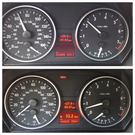
After 17 states, 70+ hours of driving, about $550 in gas, and 4523 miles (7279 km) later California welcomed me with sunshine, palm trees, and 20 lane freeways. It is a one-in-a lifetime road trip that few will have the opportunity to do so. But I am grateful that my car was perfect for the whole trip, no punctured tires (my biggest worry since the car doesn’t have a spare tire), no speeding tickets, and no belongings were lost or stolen during the whole trip. This was a solo trip of a lifetime.
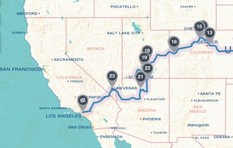
This last leg of the journey took me across some of the most amazing landscape throughout the whole trip. Starting off in the mile high city of Denver, I made a detour and headed up to the Trail Ridge Road and slowly winded my way through to out-of-this-world landscape of Utah. Then from the post-card-perfect Arizona, I passed through sin city Las Vegas and finally made my way to my new home in Los Angeles. The photos turned out great, but you’ve really got to go see it to believe how beautiful this part of America is.
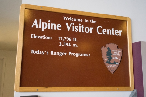
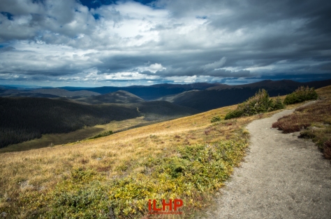
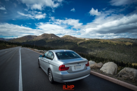
Trail Ridge Road
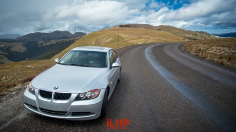
The Trail Ridge Road courses its way through the Rocky Mountain National Park, about 45mins northwest of Denver, Colorado. What sets it apart is that it is the highest paved road in North America, reaching upwards of over 12,000ft (+3600m) above sea level. Throughout the trip, I was most concerned with this leg of the journey. I’ve lived at sea level all of my life and am not in exactly my fittest physical condition after three long years of law school. Altitude sickness and oxygen depravation is no joke, I didn’t want to pass out on top of the Colorado rockies with no one around.
I’m happy to report that the experience wasn’t nearly as bad as I thought. Yes, I did feel like a small child had been sitting on my chest, so it was slightly harder to breadth than normal, but I didn’t experience any of the serious symptoms of altitude sickness (e.g. dizziness, headaches, nausea, vomiting, etc). I think spending a night in the mile high Denver really helped. What I did experience was half and half. Something amazing and something disappointing.
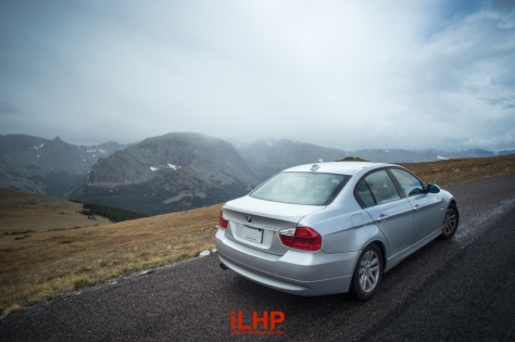
You wind your way up the mountain road on steeper gradients than the Blue Ridge Parkway. It start out like any other mountain road but there comes a point where trees disappear and you are suddenly in a inhospitable tundra. Short grasses and shrubbery grow, but there are no tall trees. Lighting strikes are a concern and weather over the TRR changes quickly. But against this backdrop is a beautiful ribbon of asphalt that was narrow and with no guardrails to protect you from a 500ft drop. Amazing!
What was seriously disappointing was the sheer volume of tourists, cars, and motorcycles driving this road. Driving excitement wise, Trail Ridge Road was essentially a 2.5 hour traffic jam up then down a mountain. Cars averaged 25-30mph. Road conditions were gravelly. There were not really any place along the route where traffic frees up. Blue Ridge Parkway in Virginia and North Carolina smokes Trail Ridge Road as a driving road.
All in all, I would still recommend anyone in the Denver area to visit the Trail Ridge Road and the Rocky Mountain National Park. In terms of the mountains itself, I prefer the sheer size of the Canadian Rockies but the summit of the TRR was definitely worth the traffic jam.
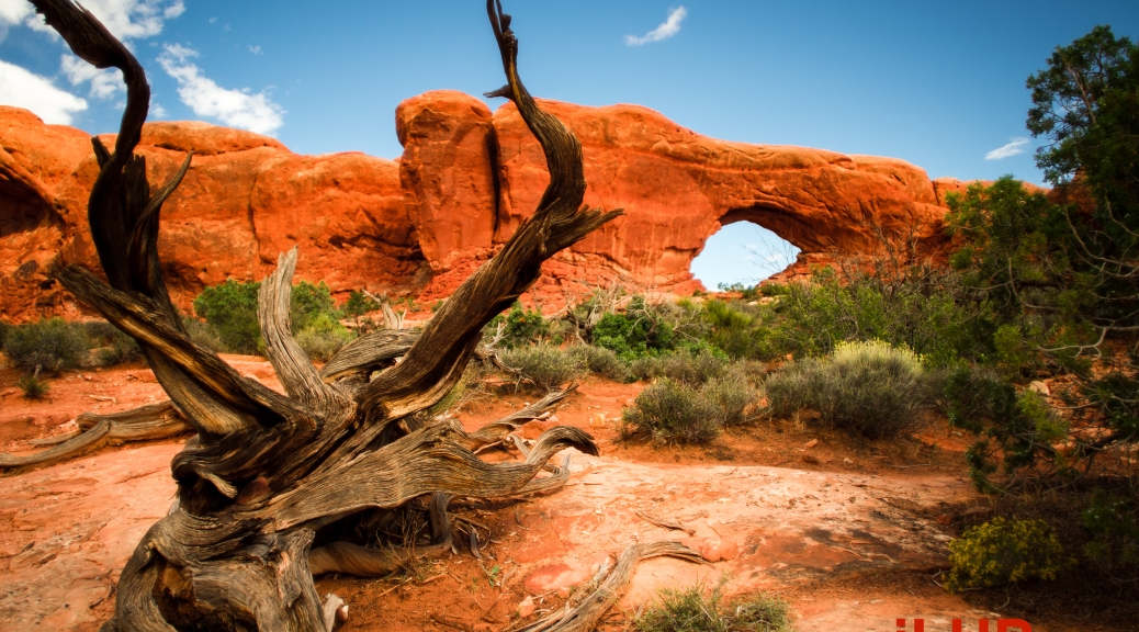
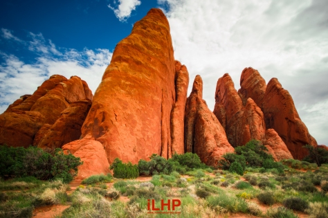
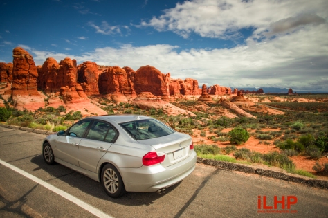
Arches National Park
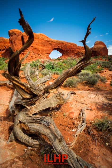
Utah is a Salvador Dali painting coming to life. It is astonishingly beautiful. It was the start of a string of states that looked nothing like the 14 I’ve driven through prior. Deep orange earth and mountains putting a smile on your face. Long straight stretches of deserted two-lane highway, completely devoid of human life or cell phone signals. I’ve died and gone to Utah.
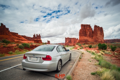
Arches National Park is in the eastern part of Utah, relatively close to the Colorado border. It is a sizable park, larger than Grand Canyon National Park South in terms of paved roads and areas to see. You could spend a solid 2-4 hours just driving and hiking it.
I realized here that my Canon FD 20mm f/2.8 has been my go to travel lens on this journey. It is on my camera 90% of the trip and it’s enabled me to capture wide slices of America. I wouldn’t say this is a great lens. It is not exceedingly sharp, flare becomes a problem with a UV filter like many ultra-wides, there is heavy vignetting and there is difficult-to-correct wavy distortion.
But at the end of the day, it got the job done. It was sharp enough for most of my photos, the field of view was excellent, and shooting was a joy simply by leaving the lens at ∞. This $150 lens is an elegant solution to the-lack-of-ultra-wide problem on the Sony A7. I may still upgrade when a better alternative is launched, but it was this lens that saw me through my travels.
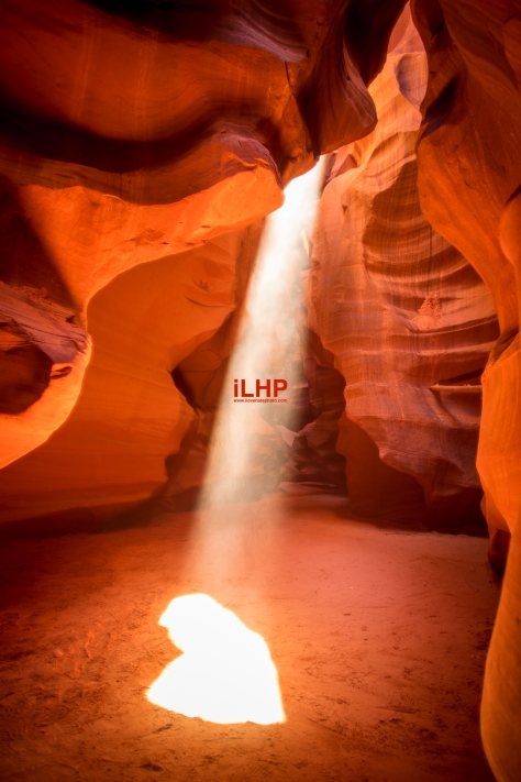
Antelope Canyon
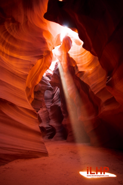
The pièce de résistance of this journey was most definitely Antelope Canyon. About a 15min drive from middle-of-nowhere Page, Arizona, the Canyon is on Navajo Tribal Lands bordering Utah and Arizona. Open up your Mac computer and you’ll see a wallpaper from this place. Actually, it’s been my laptop wallpaper for years without knowing that one day I’ll actually visit it and see for myself.
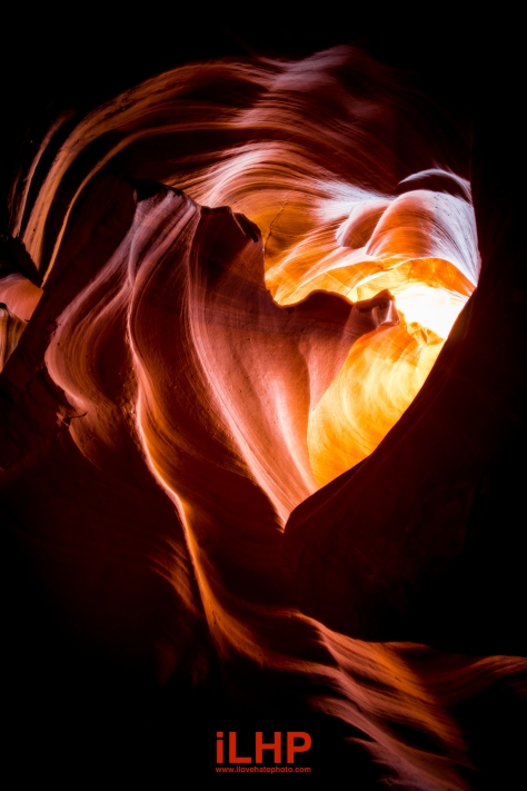
I’m not going to describe it too much right here because I’m going to do a separate article just on the Antelope Canyon, but please enjoy these photos. Shot on a tripod, the light beams only appear during the right time of day.
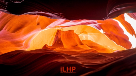
The glow and shimmer comes from the quartz within the rocks. During monsoon season, the whole canyon floods, bringing in or taking away sand so the height of the floor never stays the same. It was such an organic experience.
The smell and taste of the sand was subtly in the air. The visual tranquility of the narrow passageways reminded me of a temple or a sanctuary. What a fitting end, to a wonderful journey.

Great post. I was checking continuously this blog and I’m impressed!
Very helpful info particularly the last part 🙂 I care for such
information a lot. I was looking for this particular info
for a long time. Thank you and good luck.